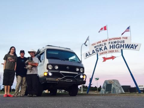
Hello all! We are WPOW (Wolf Pack On Wheels) traveling North America since June 2015 originating in New Mexico exploring backroads from New Foundland, Baja, Colorado, Florida, North West Territory, Alaska and beyond, now residing on Vancouver Island through summer. We would enjoy visiting your island back roads, Club meetings, events, camping, and all things fun with any and all of you. WPOW is Charlie, Laura, Nate (14), and Ceilidh our Shih Tzu traveling companion.
Please keep us in mind, alert us when planning to hit the trail . . .
Will someone recommend a good backroads trail map of the Island? Cheers
New to Vancouver Island
December 31, 2017 - 8:23am
#1
New to Vancouver Island

The Backroads Map book of course! Available from most gas stations, many bookstores. Has loads of information regarding logging roads, parks, campgrounds, waterfalls, caves, big trees, rivers lakes fishing paddling the list goes on and on. A bargain at $25 or so
Silly me, I’ll grab that map!
If you have a Garmin mapping GPS, I can link you to a really good free Topographic map of Vancouver Island that you would find most useful while here.
It includes the logging and service roads here and many of the well known trails and other parks and attractions on it that can help you while exploring.
I would recommend using a separate chip for it though as it will overwrite any TOPO map you already have installed on it.
Also keep in mind while you are here that on Vancouver Island in particular, a lot of our forest lands are "privately owned or managed", which means access to many areas may be restricted or subject to regular and unpredictable closures. There are still many public parks and land reserves that are open and accessible all year round and there are sometimes workarounds for closed gates if you go with locals who know the trails so you can at least have a chance to see some of the hidden treasures on the island. Spring and summer is an amazing time to be outdoors here.
Right on, thanks Rob!
Do send the link for the free TOPO map of Vancouver Island, it will be most useful come spring; I will grab a seperate chip.
Totally understand the trespassing and permission ‘first’ issues, having been denied hiking access here locally after a nice conversation and purchasing their product, $170 of ‘Double Barrel Aged Single Malt Whiskey’! Totally lame, but it is what it is, dealt with the same in Colorado and New Mexico. I will watch the forums for invitations from locals. Shoot me an email if you have anything going on.
Happy New Year!
Charlie Steven
chazsteven69@gmail.com
1.352.631.4429 cell
Here it is.
http://www.gpsfiledepot.com/maps/view/658/download/
Depending on your security settings, it should automatically prompt you to save the exe file after the page finishes loading.
Just follow the instructions on how to unpack and install it then enjoy exploring. :-)